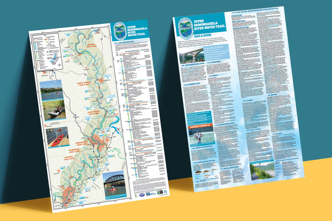
One of the projects we have been working on for over two years has been the Upper Monongahela River Water Trail map. This map was funded through grants and the state of West Virginia as a way to show boaters, kayakers, and others using the Monongahela River the various entry points and facilities along the Mon. The map is two-sided and features text featuring the types of fish in the Mon, the history of the Mon as well as safety regulations. The inner part of the map shows the map in detail from Brownsville, Pa to Fairmont, W.Va. Each stop is detailed with restaurant, hiking, biking, restroom and historical markers.
The detail that went into developing this map is pretty amazing. Presently, 63,000 maps are being distributed throughout the state of West Virginia but also in select spots in Pennsylvania. If you are looking for a map project yourself for your organization please contact us to discuss the possibilities.